
Day 6 – To Lake Tahoe
N38º 56.544' W119º 57.186'
Today we leave Klamath Falls behind, and set our sights on Lake Tahoe, where we’ll have a rest day before finishing up the ride in Carmel. First we dispensed with the obligatory email and conference calls, which was complicated by a disturbing lack of cellular reception. Then we got down to the altogether more serious business of scaring up coffee and breakfast. This we found at Gallagher’s Sports Bar, within the Running Y Ranch (which is itself a strange combination of golf resort, vacation spa, retirement community, village and speed-skating oval, all rolled into one happy package).
One breakfast later, we were ready to get on the road. We had about six hours of riding ahead of us, which with a 10am departure would have us arriving in South Lake Tahoe around 4pm. Once again, the early part of the ride was deceptive. The roads were wide open, empty and smooth, which was a fine portent for the rest of the day. Of course, that assumed things would stay relatively consistent, and we should recognize by now the healthy capacity for fantasy that I bring to these tales.
Right about here, it is probably useful to provide some context about roads and road design. For a motorcyclist, an excellent road is one that has a lot of curves and elevation changes. Or both together. The inherent challenge is that roads are designed by engineers, not motorcyclists. And engineers a have a deep and abiding fetish for straight lines. Most of the roads in North America are designed by firstly throwing down an artificial grid, roughly based upon the lines of longitude and latitude, and using that grid to draw a bunch of straight, criss-crossing lines. These would be where the roads go. The rest of the process is an exercise in attempting to make mother nature conform to this design.
The result is roads that run in straight line for as far as the eye can see and beyond, until some geographic feature that the engineers can’t mow down or blow up gets in their way. This, of course, is when the roads get interesting. Which means that the best roads for motorcycling can usually be found in close proximity to mountains, river valleys and lakes. All other roads are simply avenues for getting in between these points.
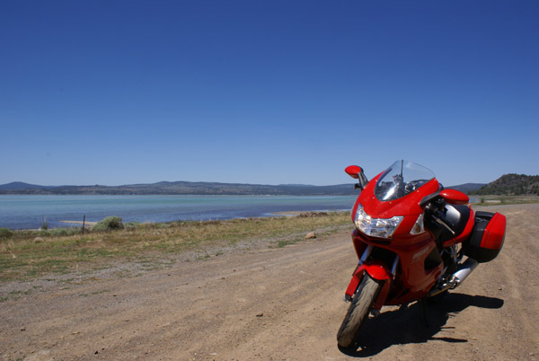
On the shore of Eagle Lake
The roads in the prairies in Canada particularly hold to this principle, and are largely drawn around the sections that make up the various farms and homesteads of the West. Given that roads can’t possibly go through someone’s land (that would be trespassin’, goldarnit) they go around. This means that rather than gently sloping bends, most of the roads in rural areas go in mind-numbingly straight lines until they turn at virtually a 90º angle. As a motorcyclist, this requires a sufficient level of alertness to shift direction radically despite having just endured several miles of doing exactly the same thing in the exact same direction. Failure to do so creates consequences that are as swift as they are brutal.
Such was the character of much of the drive through the northern-most part of California. The good news here, of course, is that we were in fact in California. Which meant that we weren’t in Oregon. This can only be considered a happy thing, as we put behind 55mph highways and mandatory full-serve gas stations (yes, indeed, the average citizen is not to be trusted with the delicate task of dispensing unleaded into vehicles in the State of Oregon; not that I know why this is the case, it simply is). At the California border, the speed limit immediately jumped to 65mph for pretty much exactly the same kind of road that we had been on in Oregon. And then it got narrower, steeper and windier, with no shoulder, runoff or guardrail. Proving that more states should probably be run by former movie action heroes; they clearly have a much higher tolerance for risks. Go, Arnold!
The first part of the ride also gave me a much more sympathetic understanding of Breton’s plight. The dedicated reader of this blog will of course recognize the above reference to the woefully small capacity of my good friend’s bladder. On the ride through to Susanville, much of the route ran through the back and beyond, with services being few and far between. Susanville was about 180 miles from where we started, although thankfully much of it was dispatched at much faster speeds than yesterday. Nonetheless, I did find myself looking forward to finding facilities once we actually did stop. The fact that the last five miles of this portion of the journey was switchback, hurtling down a mountain through multiple 25mph hairpins, should have been a source of joy. Sadly, the gentle pressure of my morning coffee made the whole experience rather… tense. It’s not fun to be riding a motorcycle when your bladder wants relief. So Breton, I do sympathize with your circumstances. But I’ll probably still mock you.
Devising plans to mock Breton.
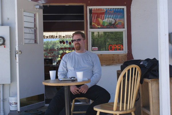
Bladder emptied and gas tank filled, Dianne and I set our sights on finding a place to rest for a bit. An inquiry at the gas station let us know that the local coffee place was to the west, while the Starbuck’s was to the east. I rather think the gas station attendant expected us to make a beeline to Starbuck’s. Adhering to our principle of going local wherever possible, however, we made a left hand turn and quickly found ourselves in the parking lot of Thunder Joe’s. We reasoned that anyone that names their coffee bar Thunder Joe’s had better make a damned fine Americano. Fortunately, we were not disappointed.
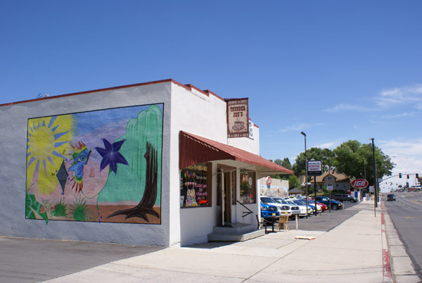
Thunder Joe’s Coffee House in Susanville.
We hung out over coffee long enough to stretch our legs and work out the kinks from three hours of non-stop driving, and psyched ourselves to get back out on the road. By the estimate of the GPS, we still had about 140 miles and two-and-a-bit hours before we finally arrived at our destination for the evening. While the road itself was in fairly reasonable condition, the number of other vehicles we had to navigate around increased significantly south of Susanville. There were enough passing lanes that this wasn’t a major challenge, but there were also enough raving nutbars out on the road as to make the experience more of a challenge than either of us would have liked. The only (very small) blessing was the reassurance of the existence of some minor deity or other, as the unhinged maniac driving an RV like it was a race car (and in nearly all passing attempts that I observed forcing on-coming traffic to swerve to avoid him) ran out of gas. Which just goes to show that sometimes it’s the little things that can provide the greatest joy.
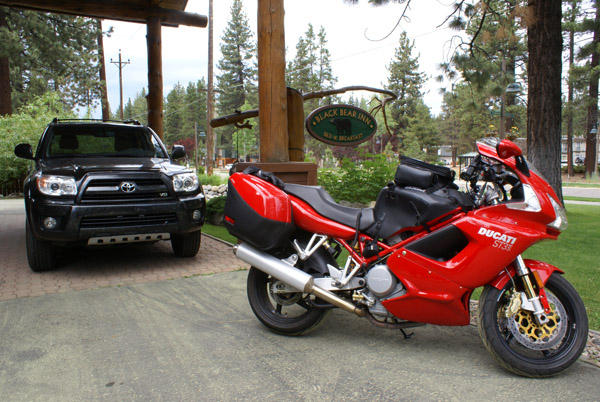
Arriving at the Black Bear Inn in Lake Tahoe
From Carson City, we finally reached the highway up to Lake Tahoe. Up being the operative word, because the road at this point climbs through 2,220 metres at its highest, and South Lake Tahoe sits at 1,900 metres.
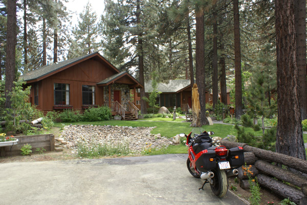
Motorcycles are not allowed in the cabins.
Even better (and we probably have some well-heeled American tax payers to thank for this) the road is gorgeous, fast and sweeping, making for an absolutely exhilarating final run of the day. And to top it all off, we pulled into the Black Bear Inn just in time for their evening wine and cheese. It truly does suck to be us.
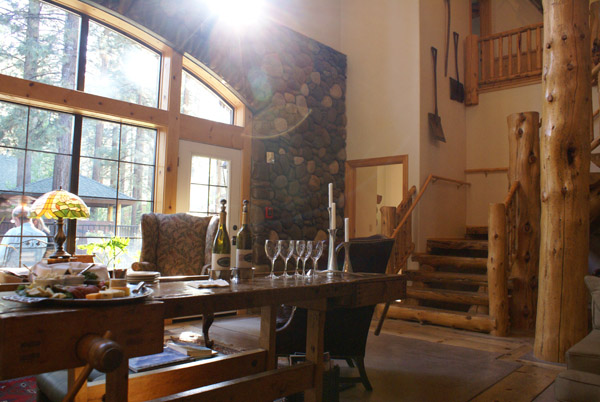
Wine and cheese in the main lodge.
After three days straight on the road and 1,568 kms travelled since we left Spokane, tomorrow is a day of rest. Even though we’re in the States, we’re taking Canada Day off. On Thursday, we will travel the final leg of our journey into Carmel, but in the meantime we’re going to spend some quality time in a little cabin in the forest and unwind.
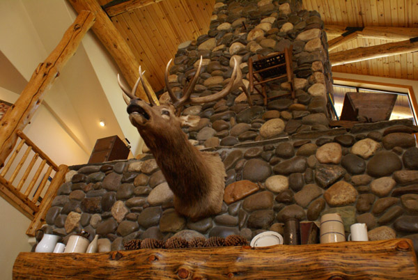
You’d probably look this pissed if they hung you on a wall, too.